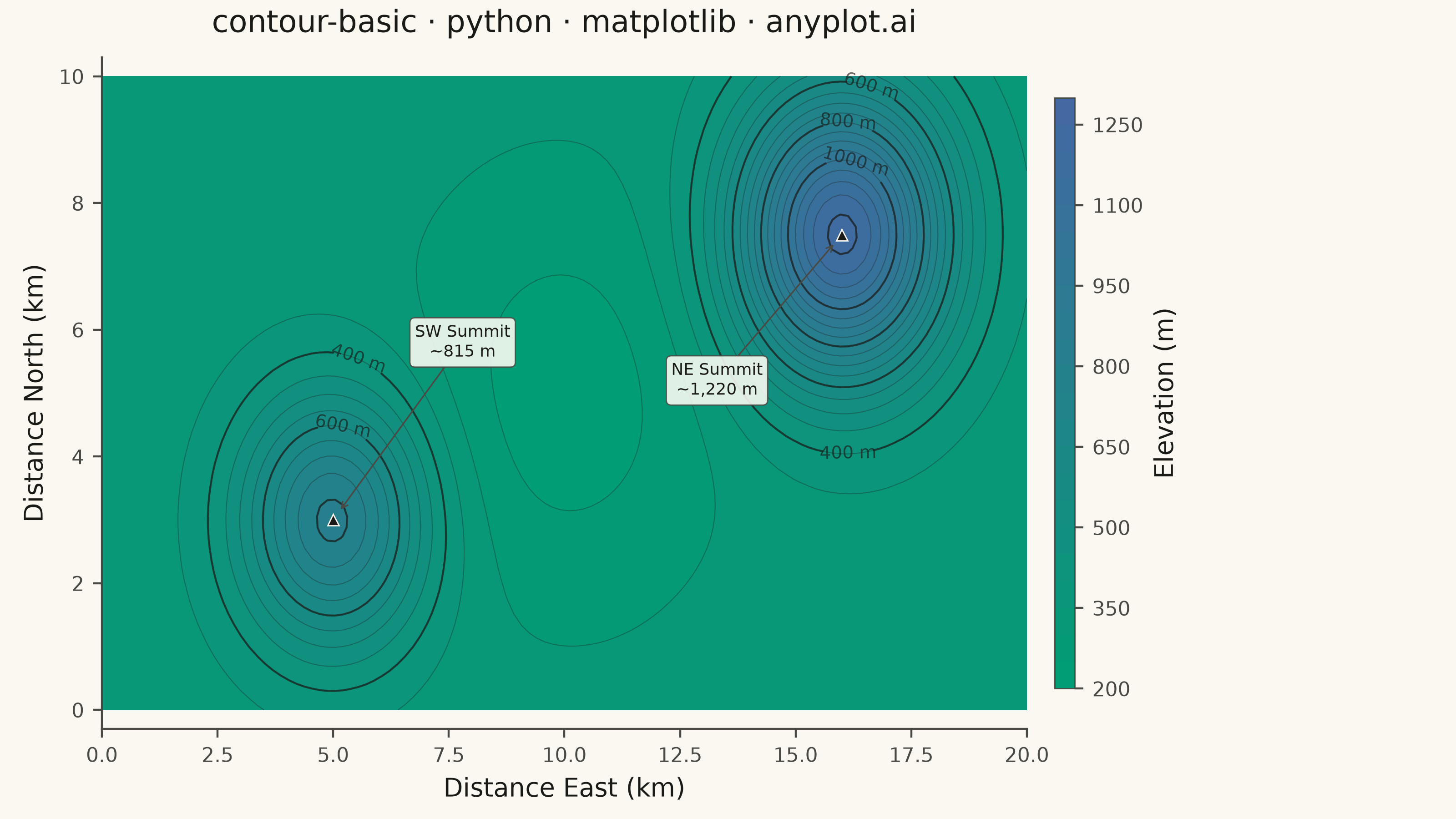
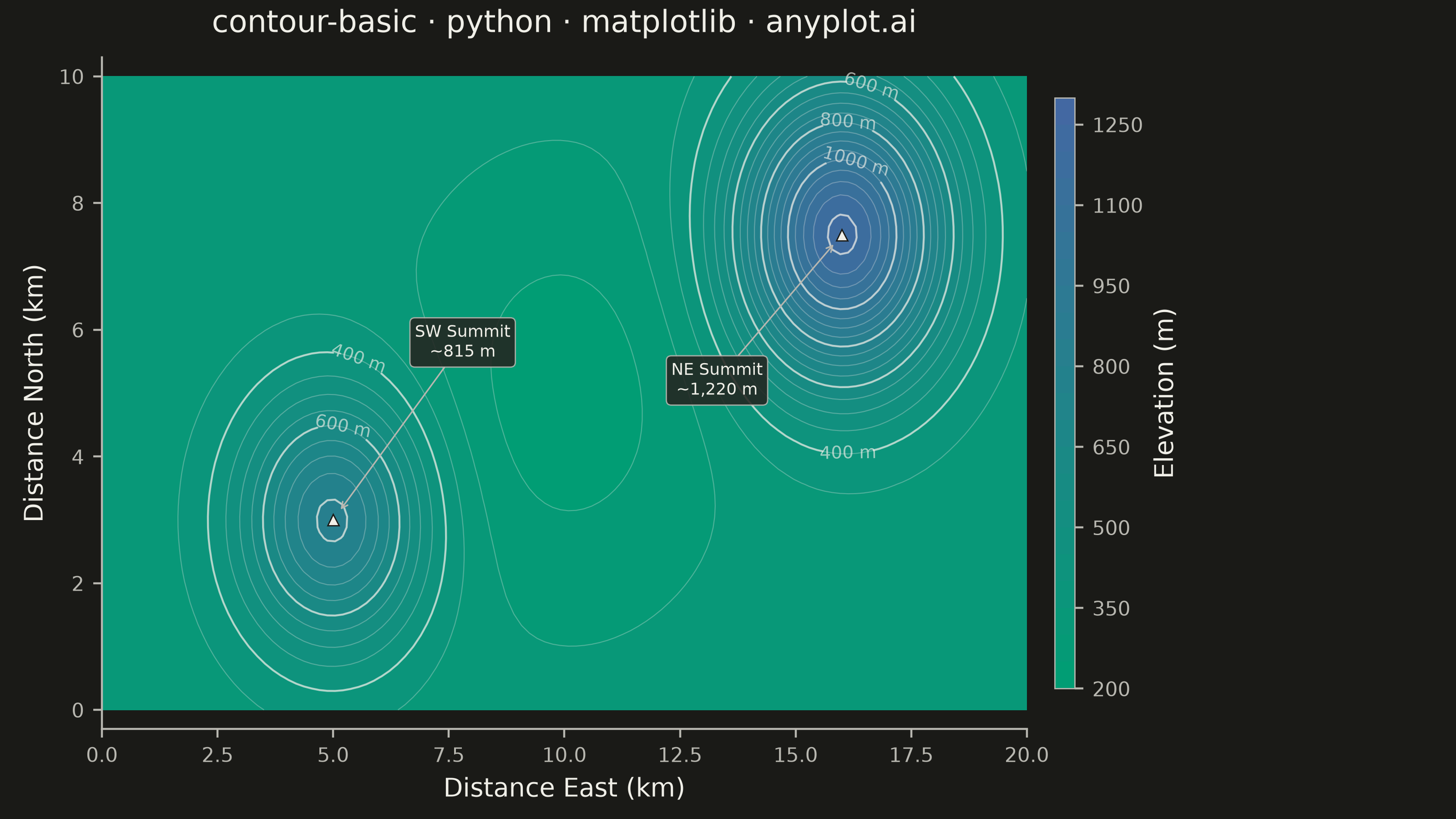
A contour plot displays isolines (level curves) of a 2D scalar field, connecting points of equal value across a surface. It transforms 3D data into an intuitive 2D representation, making it easy to identify regions of high and low values, gradients, and patterns. Contour plots are essential for visualizing continuous surfaces where the relationship between X, Y coordinates and a Z value needs to be understood.
""" anyplot.ai
contour-basic: Basic Contour Plot
Library: matplotlib 3.11.0 | Python 3.13.14
Quality: 88/100 | Updated: 2026-06-25
"""

import os

import matplotlib.pyplot as plt
import numpy as np
from matplotlib.colors import LinearSegmentedColormap


# Theme tokens
THEME = os.getenv("ANYPLOT_THEME", "light")
PAGE_BG = "#FAF8F1" if THEME == "light" else "#1A1A17"
ELEVATED_BG = "#FFFDF6" if THEME == "light" else "#242420"
INK = "#1A1A17" if THEME == "light" else "#F0EFE8"
INK_SOFT = "#4A4A44" if THEME == "light" else "#B8B7B0"

# Imprint sequential colormap for single-polarity elevation data
imprint_seq = LinearSegmentedColormap.from_list("imprint_seq", ["#009E73", "#4467A3"])

# Data — simulated topographic elevation of a 20 × 10 km mountain range
# Northeast summit ~1220 m; southwest summit ~820 m — visible height contrast
x = np.linspace(0, 20, 120)
y = np.linspace(0, 10, 60)
X, Y = np.meshgrid(x, y)

elevation = (
    900 * np.exp(-((X - 16) ** 2 + (Y - 7.5) ** 2) / 5.0)
    + 500 * np.exp(-((X - 5) ** 2 + (Y - 3) ** 2) / 4.0)
    - 100 * np.exp(-((X - 10) ** 2 + (Y - 5) ** 2) / 10.0)
    + 320
)

# Plot
fig, ax = plt.subplots(figsize=(8, 4.5), dpi=400, facecolor=PAGE_BG)
ax.set_facecolor(PAGE_BG)

levels = np.arange(200, 1301, 50)
major_levels = np.arange(400, 1301, 200)

filled = ax.contourf(X, Y, elevation, levels=levels, cmap=imprint_seq)
ax.contour(X, Y, elevation, levels=levels, colors=INK, linewidths=0.4, alpha=0.30)
major = ax.contour(X, Y, elevation, levels=major_levels, colors=INK, linewidths=0.8, alpha=0.65)
ax.clabel(major, inline=True, fontsize=7, fmt="%d m", inline_spacing=5)

# Summit markers — peak triangles with labeled elevations for data storytelling
ax.plot(16, 7.5, "^", color=INK, markersize=4.5, markeredgecolor=PAGE_BG, markeredgewidth=0.5, zorder=5)
ax.annotate(
    "NE Summit\n~1,220 m",
    xy=(16, 7.5),
    xytext=(13.3, 5.2),
    fontsize=6.5,
    color=INK,
    ha="center",
    va="center",
    arrowprops={"arrowstyle": "->", "color": INK_SOFT, "lw": 0.6, "mutation_scale": 6, "shrinkA": 0, "shrinkB": 5},
    bbox={"facecolor": ELEVATED_BG, "edgecolor": INK_SOFT, "alpha": 0.88, "boxstyle": "round,pad=0.3", "lw": 0.5},
    zorder=6,
)

ax.plot(5, 3, "^", color=INK, markersize=4.5, markeredgecolor=PAGE_BG, markeredgewidth=0.5, zorder=5)
ax.annotate(
    "SW Summit\n~815 m",
    xy=(5, 3),
    xytext=(7.8, 5.8),
    fontsize=6.5,
    color=INK,
    ha="center",
    va="center",
    arrowprops={"arrowstyle": "->", "color": INK_SOFT, "lw": 0.6, "mutation_scale": 6, "shrinkA": 0, "shrinkB": 5},
    bbox={"facecolor": ELEVATED_BG, "edgecolor": INK_SOFT, "alpha": 0.88, "boxstyle": "round,pad=0.3", "lw": 0.5},
    zorder=6,
)

# Colorbar
cbar = fig.colorbar(filled, ax=ax, shrink=0.88, aspect=30, pad=0.025)
cbar.set_label("Elevation (m)", fontsize=10, color=INK)
cbar.ax.tick_params(labelsize=8, colors=INK_SOFT)
cbar.outline.set_edgecolor(INK_SOFT)
cbar.outline.set_linewidth(0.5)

# Style
ax.set_xlabel("Distance East (km)", fontsize=10, color=INK)
ax.set_ylabel("Distance North (km)", fontsize=10, color=INK)
ax.set_title("contour-basic · python · matplotlib · anyplot.ai", fontsize=12, fontweight="medium", color=INK, pad=10)
ax.tick_params(axis="both", labelsize=8, colors=INK_SOFT)
ax.set_ylim(-0.3, 10.3)
for spine in ("top", "right"):
    ax.spines[spine].set_visible(False)
for spine in ("left", "bottom"):
    ax.spines[spine].set_color(INK_SOFT)

fig.subplots_adjust(left=0.07, right=0.84, top=0.93, bottom=0.11)
plt.savefig(f"plot-{THEME}.png", dpi=400, facecolor=PAGE_BG)
Runnable source as JSON, for any HTTP client: https://api.anyplot.ai/specs/contour-basic/matplotlib/code. Any spec id and library id listed in llms-full.txt fit the same URL shape; every URL below is complete and callable.
{
  "spec_id": "contour-basic",
  "language": "python",
  "library": "matplotlib",
  "page": "https://anyplot.ai/contour-basic/python/matplotlib",
  "hub": "https://anyplot.ai/contour-basic",
  "code_json": "https://api.anyplot.ai/specs/contour-basic/matplotlib/code",
  "spec_json": "https://api.anyplot.ai/specs/contour-basic",
  "render_light_png": "https://storage.googleapis.com/anyplot-images/plots/contour-basic/python/matplotlib/plot-light.png",
  "render_dark_png": "https://storage.googleapis.com/anyplot-images/plots/contour-basic/python/matplotlib/plot-dark.png",
  "quality_score": 88.0,
  "license": "MIT",
  "guide": "https://anyplot.ai/llms.txt"
}
Part of Basic Contour Plot on anyplot.ai.